
Bumpy Roads
Tumultuous terrain on public lands in Utah

In 1879, two hundred fifty Mormon pioneers set off from Cedar City, Utah, on a 205-mile journey, directed by Brigham Young to create a new Latter Day Saint settlement on the San Juan River. The year before, a small scouting party traveled through northeastern Arizona and the Navajo Nation, but they decided to take a shortcut. No one in the party had yet taken the new way, and regional maps did not exist yet. Instead, they leaned fully upon their faith.
They resupplied provisions at the last outpost of civilization, the town of Potato Valley (now Escalante), Utah. The hamlet was named for a wild variety of spud introduced to them by the local band of Paiute people. Starch on a 10,900-year-old stone tool found there makes it the location of the earliest wild potato consumption in North America.
For over sixty-two miles, the wagons bumped along across a vast grassland where the grass “stood belly deep on a horse,” according to one account. They took some time for a few dance parties, under an alcove now commemorating the trip as Dance Hall Rock. Then, the pioneers reached a cliff overlooking the Colorado River.
A major snowfall made turning back undesirable. So, they opted to spend over a month blasting a 200-foot ramp down a cleft in the cliffs. From there, they used ropes to lower eighty-three wagons through the Hole-in-the-Rock. Another one thousand vertical feet of steep, rocky slopes spread over a quarter mile descended toward the Colorado River.
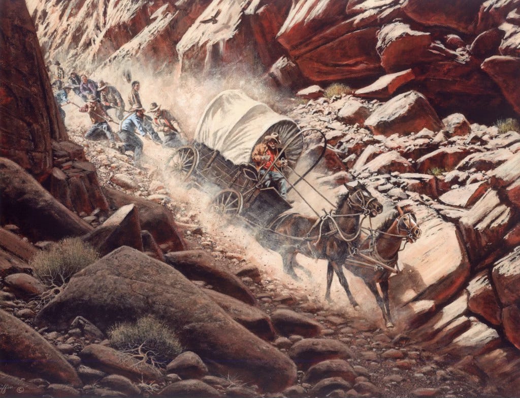
The expedition party, mostly families, presumed that was the hardest part of their journey. Instead, they crossed the river, and the terrain got rougher. Explosives were used to break the trail. The route traversed Grey Mesa through a foot of snow and headed toward Lake Canyon. There, women and children enjoyed a welcome break by the water while the men scouted the next move.
Beyond the Clay Hills, steep defiles of rainbow-hued Chinle formation, the line wagon paralleled Grand Gulch and wheeled across Cedar Mesa. Finally, they found a way up and over Comb Ridge, a steep monocline of sandstone, near the San Juan River, where they settled the town of Bluff. Astonishingly, nobody died during the pilgrimage, and three babies were born.
The Hole-in-the-Rock road remains a modern pilgrimage for many Latter-day Saint families and a popular Jeep and OHV route. Most folks are familiar with the sixty-two miles of dirt road launching east from Escalante, Utah. The road is notoriously dusty and washboarded. If you drive down after a heavy storm, you'd better have supplies to hang out for a while. This is a tactic I used to deploy to stay longer in the canyons. The road ends just shy of the blasted hole-in-the-rock. Regardless, cars of all makes and models attempt the road during peak season.
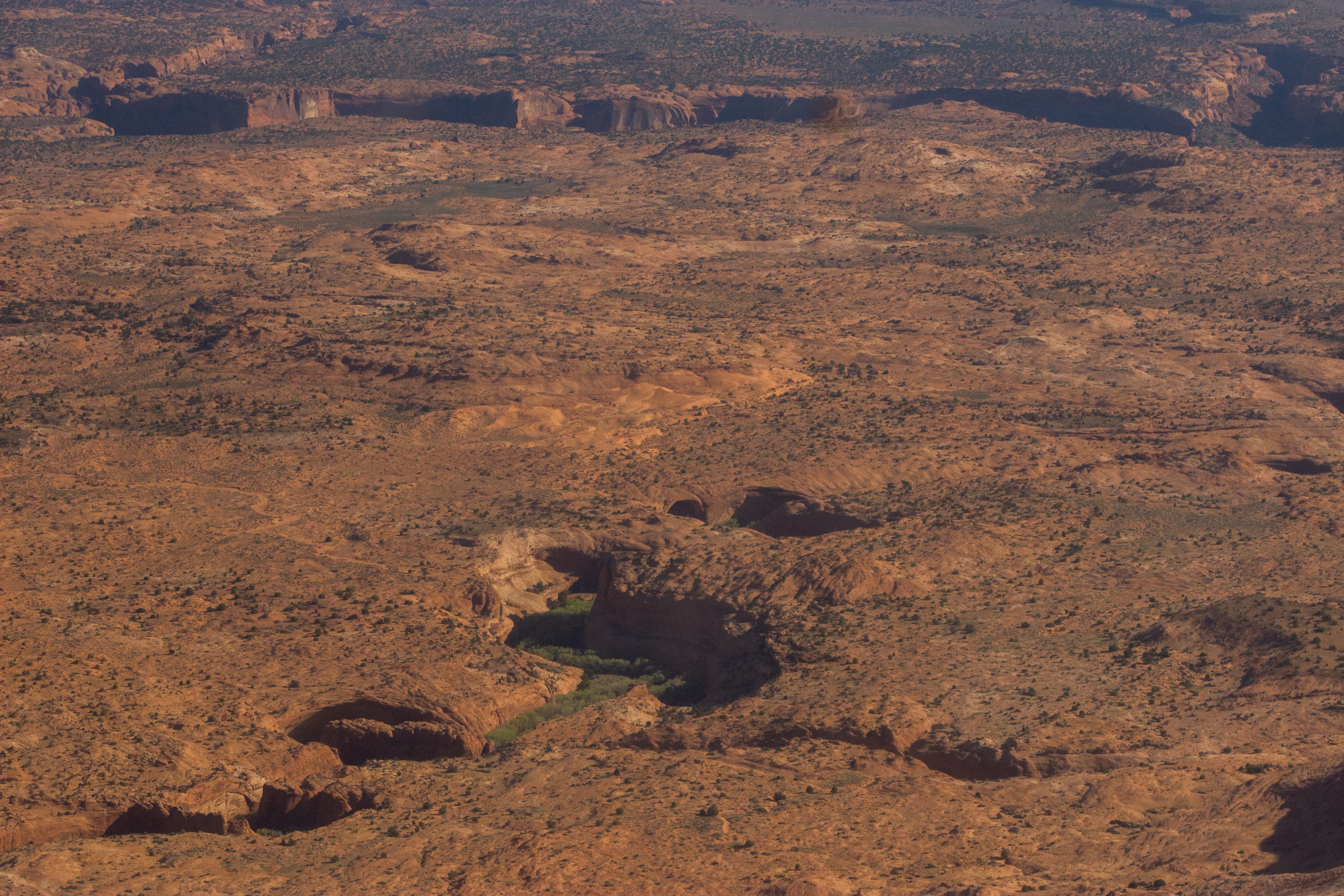
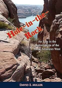
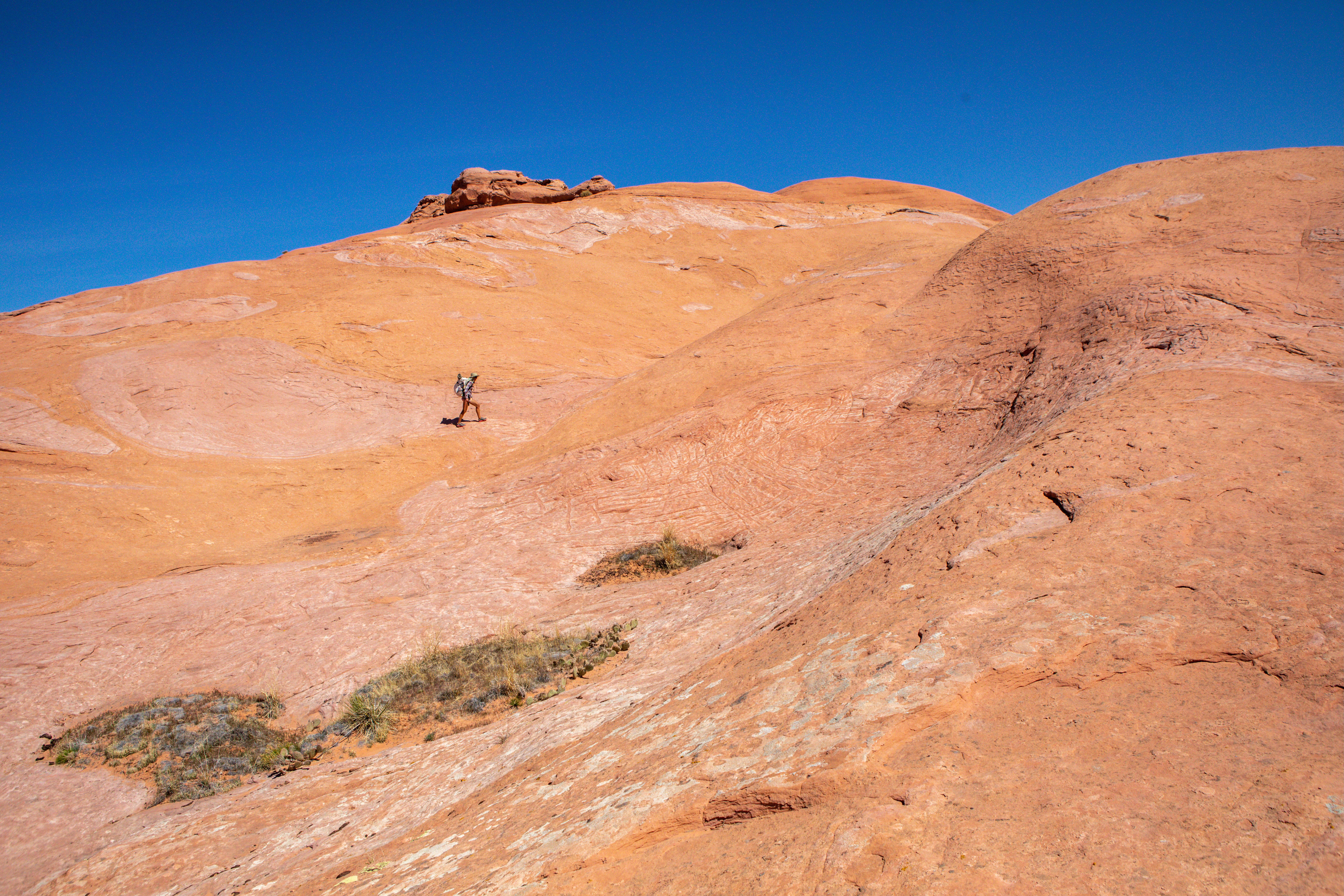
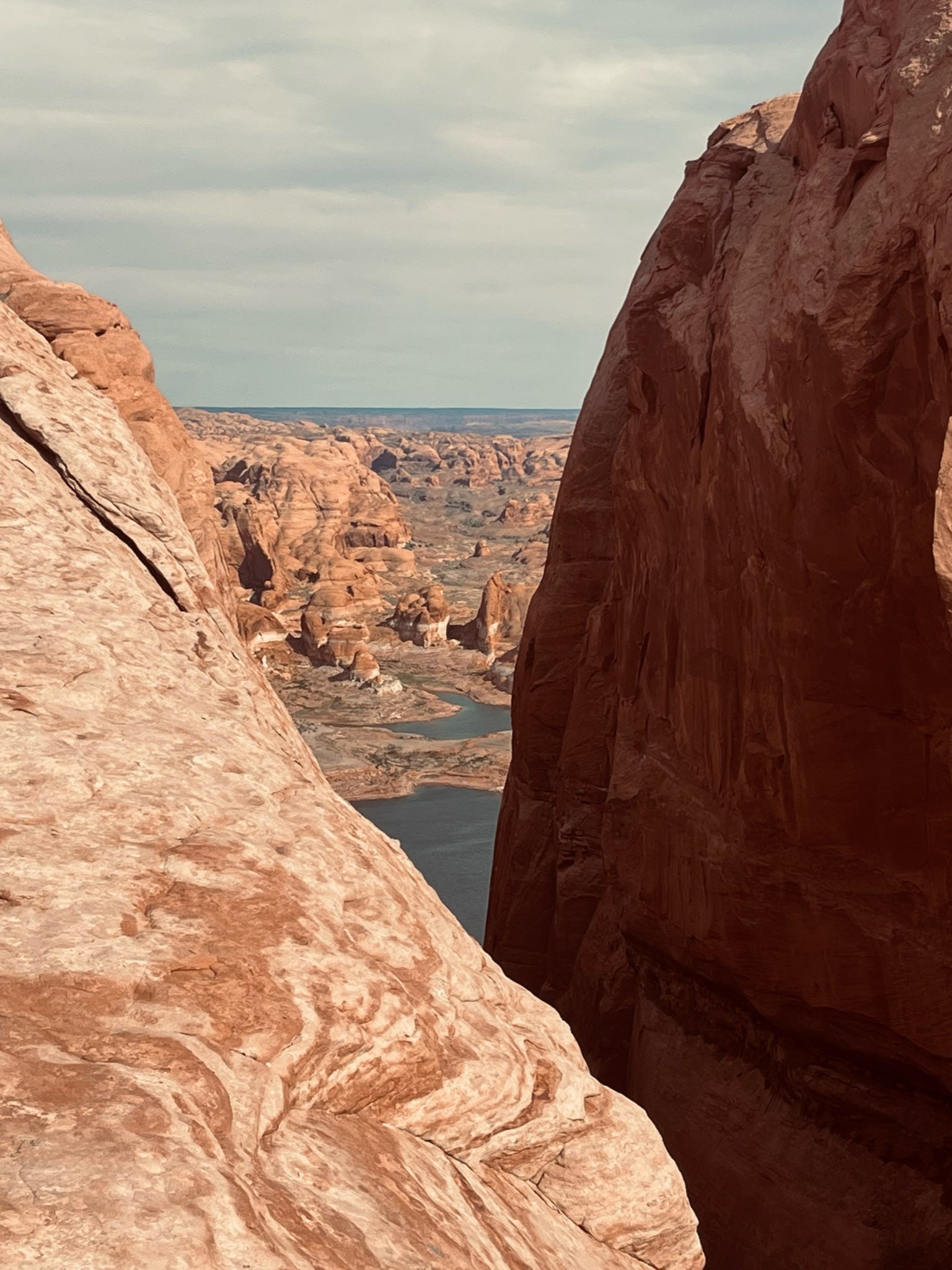
From here, the Hole-in-the-Rock route is less frequented. Where the wagons first crossed the Colorado River on a wooden raft, now there is a reservoir. Lake Powell’s low water levels now reveal the impressive road grade (pictured above) constructed by the pioneers. If you continue, you will find yourself on the far more rugged and unruly section of the Hole-in-the-Rock route. This I hiked in the spring of 2021 while retracing the 1929 Bernheimer Expedition recounted in Path of Light. (The above passage about the Hole-in-the-Rock Expedition is excerpted from that book.)
Some stretches of the “road” are so steep that I dreaded walking up them. It did not help that I carried up to four gallons of water in my backpack in case the potholes were dry. The 1879 Expedition took place in winter with several feet of snow on the ground. Tough as that may be, snow increases the odds of survival. As a result of two decades of extreme drought, the worst in 1,200 years, the route now traverses a mostly dry expanse of desert.
This is why I became so fascinated with the expedition. The journals, mostly kept by women, are a critical record of what this landscape and climate were like 147 years ago. Change is inevitable, but knowing the specifics of that change helps us contextualize the spaces we now inhabit and visit. Gone are the grasses that stood belly deep on a horse, because of overgrazing. Rare are the winters that produce several feet of snow. These records document increasing human impacts on land, water, and climate. If we take note, they can help us course correct to hopefully protect what remains for future generations.
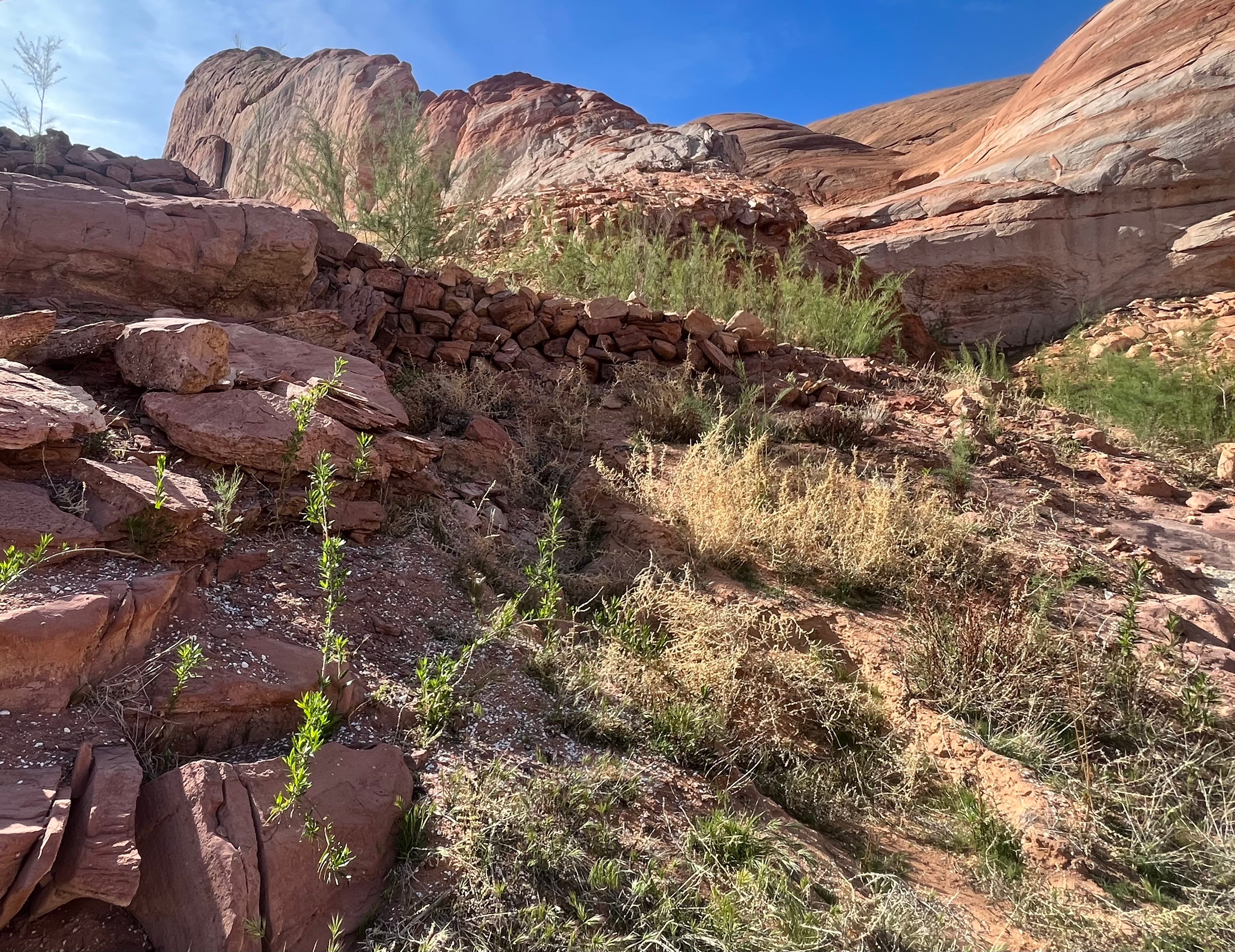
A fifty-pound backpack does not compare to the challenges of traveling by horse-pulled wagon on a convoluted, unproven overland route, enhanced with dynamite, in winter. Stepping next to the tracks incised into the sandstone by wooden wagon wheels is a humbling reminder of how difficult passage through this terrain was and still is.
Driving in an air-conditioned luxury vehicle or whip speed OHV certainly removes almost all of the hardship. However, each time my wheels bump a fallen rock, and the cab bounces while crossing a rut, it is a reminder of why Hole-in-the-Rock road exists. It was created by people so wildly devoted to their faith that they willingly lowered their families over the edge of a cliff toward a raging muddy river.
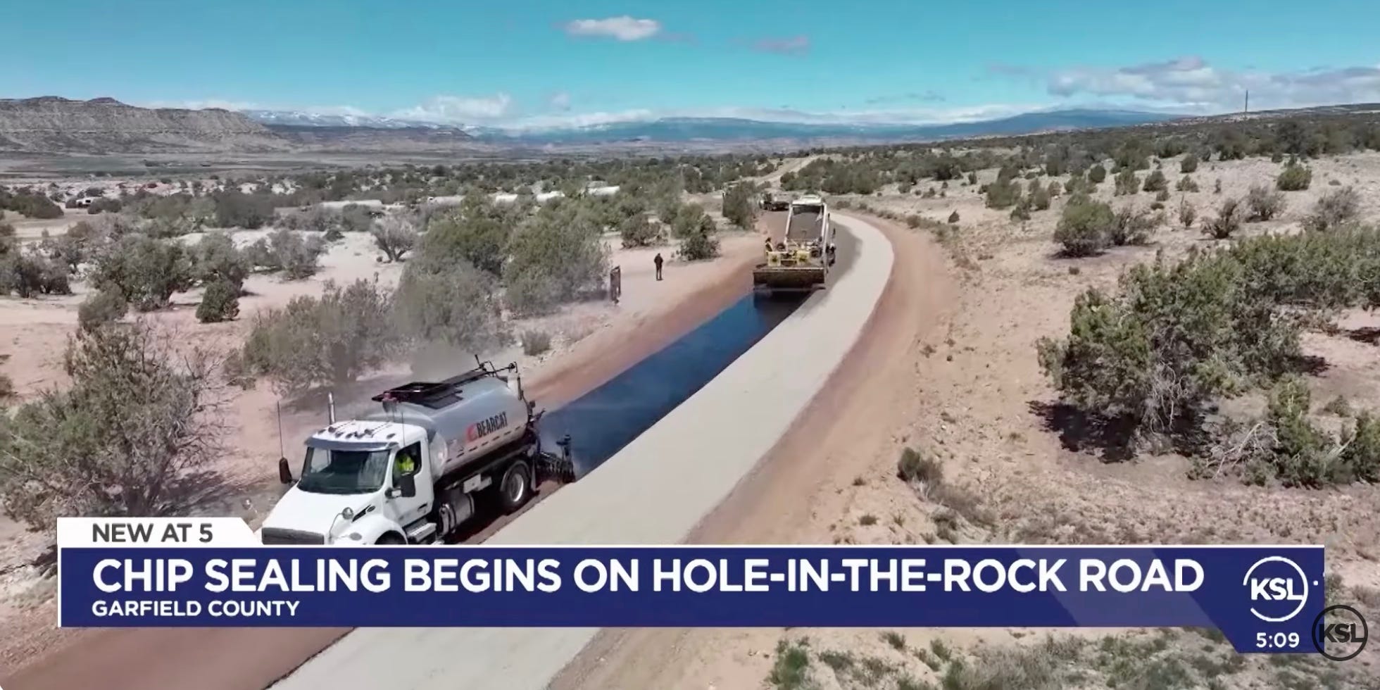
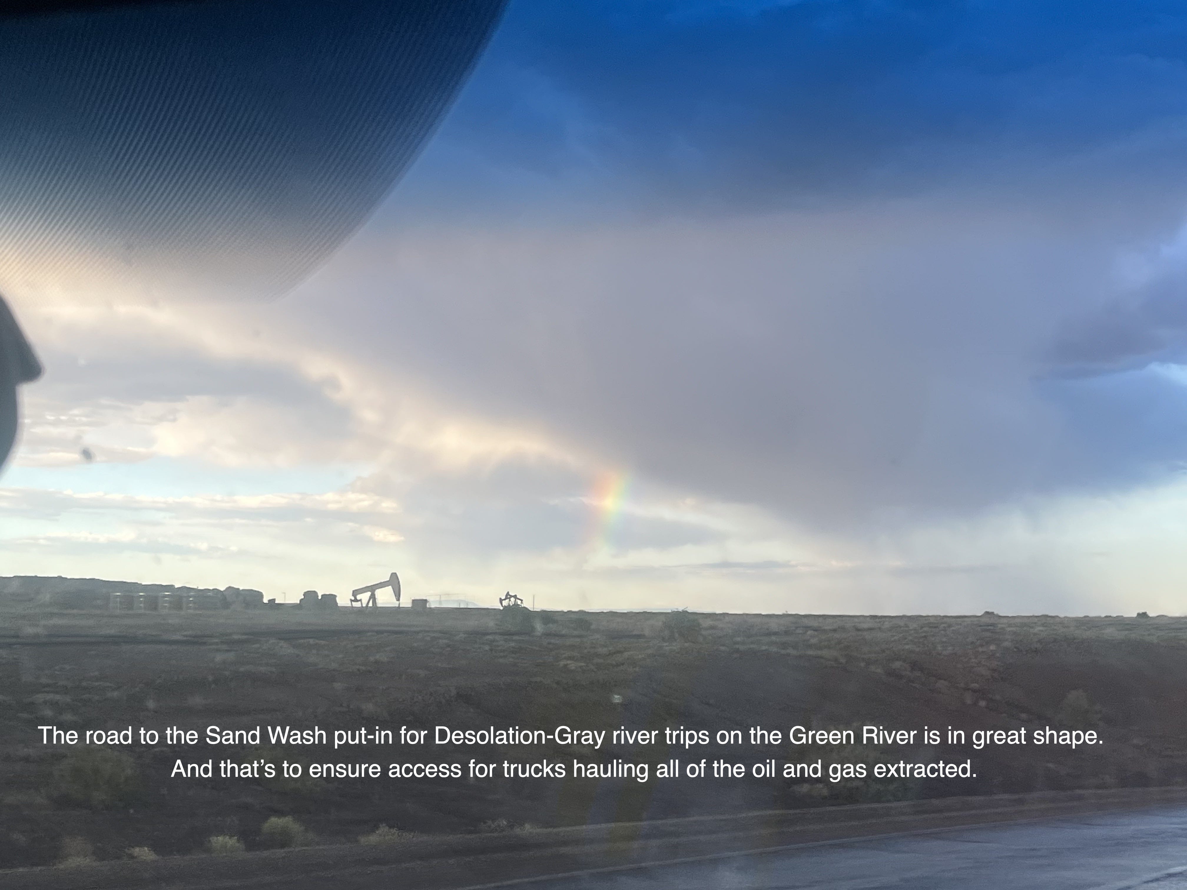
Last month, Garfield County chip-sealed the first ten miles of Hole-in-the-Rock road. Garfield County began preparing the road this spring. In response, Southern Utah Wilderness Alliance (SUWA) filed a lawsuit, citing that these “improvements” were unauthorized. SUWA’s statement explains:
“While Garfield County has title to a right-of-way for the road, it does not own the road or the land beneath it (this remains federal public land), and it cannot lawfully take unilateral action to improve the road. Instead, the county is required to consult with the BLM before making any improvements, such as widening or realigning the road, installing new culverts, or chip sealing the surface.”
The Bureau of Land Management completed its consultation anyway, and Southern Utah Wilderness Alliance (SUWA) filed a temporary restraining order that was denied by the court. The environmental group continues to seek an emergency injunction to halt the project, but the county is laying down the pavement and bragging about it online.
KSL News Utah news outlet described the issue as a debate between improving access and preserving an experience. Garfield County pointed to an average of 1,500 cars traveling the road on busy weekends, most ill-equipped rental cars, as the motive for the chip sealing. Dave Dodds, Garfield County Public Works Director, stated the county does not have plans to extend the road, nor is it a cost or responsibility they want to incur.
Ten miles of chip-sealed road may sound like a minor issue right now, but it is representative of Utah being the epicenter of efforts to dismantle public lands. This spring, Utah delegates Celeste Meloy and Mike Lee attempted to use the Congressional Review Act to overturn the Grand Staircase-Escalante National Monument management plans. Thankfully, the CRA scheme failed when the Senate missed a 60-day deadline to vote on it last week.
The Utah delegates claimed that past management plans were created without local input. Complaints that the Grand Staircase management plans were created without public input are unfounded. Federal land management already comes with requirements for local input, and it is accessible for free (or very low permit rates) for people from all over the world. The current plan, in place since 2025, was developed with local input, including rural community members, businesses, scientists, and the Grand Staircase-Escalante National Monument Inter-Tribal Coalition. The monument itself protects a landscape that is a desert archive filled with human history––Indigenous, settler, and scientific. However, local input does not mean perfect consensus, nor is that possible.
Local input will not be so local if these lands are leased to foreign extractive industries or sold by the state to private owners. Then the “No Trespassing” signs pop up. Worse, these oil, gas, and mining leases are often filed by foreign corporations (more here) with no connection to, or care for, these rural communities.
Paving the road is a nod toward the movement to redirect public (federal) lands into local and state hands as a means to regain local control. But the land within Utah already belonged to the Federal Government before it gained statehood. (And to Indigenous peoples long before settlers arrived.)
Utah recently signed a co-management agreement with the BLM in the San Rafael Swell Recreation Area. Critics say to watch for increased prioritization of motorized access, which is already underway with last month’s BLM comment period focused on reopening Swell travel routes.
Steve Bloch, Legal Director for the Southern Utah Wilderness Alliance (SUWA), also cautions,
“Gov. Cox has found a willing partner in the Trump administration, who sees public lands as little more than figures on a ‘balance sheet’ to be dismantled and monetized for short-term gain. We will be watching closely for any shenanigans that stem from this agreement.”
The BLM has also announced a comment period to review three travel management plans in Utah. Their purpose:
With these efforts, the BLM is seeking to restore balanced land management and improve multiple-use management, consistent with the President Trump’s recent direction in Executive Order 14408, “Removing Unnecessary and Counterproductive Restrictions on Access to Federal Lands,” and future revision of Off-Road Vehicle regulations at 43 CFR 8340. Until a formal rulemaking is completed, the agency will comply with current governing regulations and will look toward how best to implement the president’s vision for travel management plans that improve access for all Americans.
Yikes! This is in direct reference to the Trump administration’s recently repeal of Executive Orders 11644 and 11989, which were issued by Presidents Nixon and Carter. Off-road vehicle use was previously unrestricted, and these EO’s created designated road/trail areas to prevent rampant impacts and destruction of natural areas.
The status of public lands, management plans, and the roads within them have become pawns in the culture wars in the not-so-wild, and over-developing West. Everyone is so damn focused on their recreation group of allegiance that they forget to consider the bigger picture, on both sides. Representatives looking to improve public lands “access” are not actually looking out for the public. Find a well-maintained dirt or paved road on public land, and it likely leads to extractive activity of some form. Public support for such road improvements will help the extractive industries gain the access that they want.
I may be what some folks call a “tree hugger,” but I love driving rough dirt roads. For three years, I lived out of a 2002 Jeep Wrangler and wrote Outlandish, about the experience. I learned overlanding skills from my uncle, who hosted a Jeep TV show in the nineties. We had vastly different political beliefs, but we bonded over our love of time outdoors and care for the future of the landscapes we explored.
4-wheel driving is still how I access backcountry terrain to explore on foot. When the road ends, I can step into a vast roadless area of desert spanning millions of acres. For now.
On June 10, Sen. Mike Lee (he who does not quit the bad ideas) slipped a last minute ammendment to repeal the Roadless Rule in legislation (the Wildfire Prevention Act) which was passed by the Senate Energy and Natural Resources Committee. It can now head to the Senate Floor for a final vote this month.
The Roadless Rule was passed in 2001, with popular support. Out of 1.6 million public comments about the rule, 97% were in favor of it. The Roadless Rule currently protects over 58 million acres of Forest Service land. 4 million acres are in Utah.
These Roadless areas protect healthy watersheds that are essential to clean water for wildlife & humans. Roadless areas are essential to maintain critical wildlife habitats and migration corridors, many of which protect endangered species. Endemic, rare, & endangered plants are often found in roadless areas. A rule change could decimate these precious areas of biodiversity.
The amendment is guised as fire management, but it is a lie. Most wildfires are human-caused, and the majority start within a half mile of a road. (More here.)Wildfire mitigation is not necessarily enhanced by the presence of roads, and it comes with increased risk of fires.
There are already 370,000 miles of Forest Service Roads. Many of these were built for logging and extraction, not recreation, and they dead-end abruptly.1 NPR reports that the Roadless Rule was created in part because the Forest Service did not have the funds to manage the roads it already has. Now their funding is slashed by another 60% by the current administration.
Write your lawmakers about the Roadless Rule here.
Our future depends upon preserving ecosystems and history, not paving it over. This is especially prescient as the Trump Administration attempts to dismantle interpretive signage in the National Park System. A Federal judge has ordered that the signs be restored.
It is critical to preserve history, even when it was complicated. In 2025, Garfield County attempted to rename the historic Burr Trail the “Donald J. Trump Presidential Burr Trail Backway.” Successful pushback came from all demographics, but most consequentially from the descendants of the Burr Family.
Hole in the Rock blasts through the natural contours of the canyon landscape, which highlights a blatant difference in settler values that ignore knowledge from Indigenous people who lived in this landscape since time immemorial. This includes the ancestors of the Hopi Tribe, Kaibab Band of Paiute Indians, Navajo Nation, Paiute Indian Tribe of Utah, Ute Mountain Ute Tribe, and the Zuni Tribe.
The “Hole” at the end of the road overlooks the Colorado River. The route was a “one and done” in that it was not regularly used after the famous namesake venture it was born from. We do not always need new roads.
Chip sealing a historic route, one so intrinsically linked to the settlement of this region, is more consequential than a name change. Hole in the Rock road is a relic of a bygone era. One in which life was hard, and the desert was vast, and there were no paper maps or mobile devices to guide you. (Sinuhe Xavier explains this well in “Convenience is the Enemy.”) When the road ends, it beckons some of us to explore on foot. Or, even if we stop there, our lives can still be filled with the mystery of places unknown to us, stirring our imagination about the big, beautiful planet we call home.
I prefer to take the bumpy roads over traffic jams. It is grounding to live in a landscape that so broadly archives the past, as the world of technology changes faster than any of us can keep pace with. This also includes keeping up with the rocky terrain of public lands management.
In 2022, Garfield and Kane Counties joined the state of Utah and Blue Ribbon Coalition (BRC) in suing the Federal Government over President Biden’s restoration of Grand Staircase-Escalante and Bears Ears National Monuments’ full boundaries. The lower court dismissed the cases in 2023, citing that the “sovereign immunity” of a President’s use of the Antiquities Act was not reviewable. The state and counties appealed.
This week, the 10th Circuit court assessed that the Presidential monument designation is up for judicial review. It maintained the dismissal of the BRC case. This does not affect the current boundaries of either monument. It sends the state and county level case back to the same court that dismissed it a few years ago.2
This sets a precedent for continued attacks on the Antiquities Act and national monuments. This is not a final decision; it just means litigation continues. As I reported for Sierra Magazine last year, for over a century, the courts have continually defended the president's ability to create or enlarge, but not dismantle, national monuments.
To learn more, I highly recommend reading Crossings by Ben Goldfarb.
Two different press releases about the same issue: https://suwa.org/suwa-statement-on-tenth-circuit-decision-over-long-running-attack-on-national-monuments-6-23-26/?utm_source=ig&utm_medium=social&utm_content=link_in_bio
https://www.courthousenews.com/10th-circuit-revives-review-of-bidens-utah-monument-expansion/
Thanks for highlighting the nightmare the removal (recission) of the Roadless Rule will create in the southwest and other parts of the nation!
These places are sacred to local indigenous people and to those of us who love the land and want it to remain the land (not the route to somewhere else).
Thanks Mo, well written and informative as always. I take heart that Trumps schemes are EOs and are easy to reverse if the party is defeated. Well that thought helps keeps me sane. It’s not easy to start up extraction work, it takes time and money. Big business is not likely to invest knowing that in two years it could all be reversed. I’ll bet the monuments removed and hid the signage just waiting for the day to reinstall it.
In the meantime keep your tire pressure low and smooth out the bumps.